The solutions seem fairly obvious. Executing them is another matter.
This is Part III of a four-part series about groundwater basins in Colorado. The story was commissioned by Water Education Colorado and appears in a variant form in the summer 2025 issue of Headwaters magazine. Photos by Allen Best unless otherwise noted.
by Allen Best
Center, as its name implies, lies at the center of the San Luis Valley. The valley is among the nation’s two most prominent places for growing potatoes. Among the growers is a fourth-generation family operation, Aspen Produce LLC.
Jake Burris married into the family. In addition to spuds, the family grows barley and alfalfa on 3,500 acres. Some neighboring farmers also grow canola. Burris is president of the board of managers of one of six subdistricts in the San Luis Valley’s Rio Grande Water Conservation District. His subdistrict — called Subdistrict No. 1 — was formed in 2006 in response to a declining water table. What’s known as the unconfined aquifer supports this area, the most agriculturally productive in the San Luis Valley. With just seven inches of annual precipitation, irrigation in the San Luis Valley is everything. And in Subdistrict 1, much of that water comes from 3,617 wells..

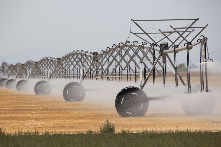
Alfalfa grown is quite thirsty, but potatoes get grown on much larger areas of the Rio Grande Water Conservancy District.
Alfalfa is the thirstiest crop, using 24 to 36 inches of water to get three cuttings. The strong sunshine and cooler temperatures found above elevations of 7,000 feet produce a high-quality hay that draws orders from dairies as far as California. Alfalfa is grown on 21,100 acres in the district. Potatoes cover 51,100 acres. Barley is grown on 28,000 acres. Some have replaced barley with rye. Several thousand acres have together been devoted to canola, lettuce, and other crops. A recent census found about 25,000 acres had been fallowed.
The San Luis Valley has two primary aquifers. Lower in the ground, separated by relatively impermeable beds of clay from what lies above, is the confined aquifer. The first well into the confined aquifer was bored in 1887. Because of the pressures underground, it was an artesian well. No pumping was needed to bring water to the surface. Louis Carpenter, a professor at the Colorado Agriculture College (now Colorado State University), estimated the valley had 2,000 artesian wells when he visited in 1891.
The unconfined aquifer lies above the confined aquifer. The unconfined aquifer existed prior to major water development in the valley but water volumes rose greatly when farms began using Rio Grande water in the 1880s. Four ditches deliver Rio Grande water to the farms and hence to the aquifer. Introduction of high-capacity pumps in the 1950s and center-pivot sprinklers in the 1970s accelerated groundwater extraction. In 1972, the state engineer imposed a moratorium on new wells from the confined aquifer, followed in 1981 by a moratorium on new wells in the unconfined aquifer. These moratoria acknowledge that groundwater drafting had to be limited.
Then came 2002, hot and dry, escalating the challenge. Impact to the unconfined aquifer was drastic with rising temperatures causing growing water demand even as snowpack declined.
The unconfined aquifer “has been dropping overall since about 2002,” says Craig Cotten, the Colorado Division of Water Resources engineer for Division 3, which encompasses the San Luis Valley. “We just have not had a real good series of years as far as the surface water.”
In 2004, state legislators passed a law that sets the San Luis Valley’s aquifers apart from those of the Republican River and Denver Basin groundwater stories. That law, SB04-222, explicitly orders both the confined and unconfined aquifers in the San Luis Valley be managed for sustainability. The Colorado law governing the Denver Basin aquifers requires a “slow sip” but does not imagine sustainability. In the Republican River Basin, no law speaks to sustainability. There, only the interstate compact insists upon limits.

Amber Pacheco shows a seed mix being planted with a no-till drill at the Peachwood Farm north of Moffat. The intent is to resort the land to native vegetation over a period of several years. The farm was purchased by the Rio Grande Water Conservation District and has been put into a conservation easement held by Colorado Open Lands. The easement consists of land formerly irrigated by 12 center-pivot sprinklers. This is believed to be the nation’s first parcel of land put under a groundwater conservation easement. Photo/Matthew Lit
Here’s another difference. Water from aquifers create the Republican River and its tributaries. In the south-metro area, surface streams cause little recharge to the Denver Basin aquifers. In the San Luis Valley, the Rio Grande as well as some surface streams coming off the San Juans contribute water to both the unconfined and confined aquifers. The hydrogeology is more complex.
This 2004 law also encouraged the formation of groundwater subdistricts within the Rio Grande Water Conservation District. The thinking was that very local groups of farmers could work together to figure out how to keep their portions of the aquifers sustainable. They could also be more effective in this pursuit by working together than doing so individually.
Six subdistricts have been created in the Rio Grande Water Conservation District and one in the Trinchera Water Conservancy District. Subdistrict No. 1 began operations in 2012 after the state approved its operating plan.
All these groundwater districts have the goal of reducing water consumption as necessary to replenish the aquifers or by introducing water into the aquifer from the Rio Grande or other sources.

Agriculture constitutes nearly the entire economy of the San Luis Valley.
Exactly how much restoration of the aquifers is needed? The state law specified a return to volumes that approximate those of 1976 to 2001 in the confined aquifer. But there’s some guesswork about how much water the confined aquifer had then. Detailed records on Subdistrict No. 1 were not kept until 1976.
In August 2024 the unconfined aquifer in Subdistrict 1 was estimated to have averaged almost 1.2 million acre-feet less water during the five preceding years than it had in 1976. The rules approved by the Colorado Supreme Court in 2011 in a document called the Plan for Water Management call for the unconfined aquifer recovery within 200,000 to 400,000 acre-feet of where it was in 1976. That would be deemed sustainable, as ordered by the 2004 law.
To achieve this, the state engineer said that Subdistrict No. 1 would need to recover 170,000 acre-feet each year between now and 2031. Initially, Subdistrict No. 1 aimed to take 40,000 acres out of irrigation per year, or about 80,000 acre-feet of annual groundwater pumping, to allow the unconfined aquifer to recover. That goal is unattainable, say water officials, and hence a rethink is needed. Success has occurred, though. In 2024, for example, roughly 176,000 acre-feet were pumped from the confined and unconfined aquifers in Subdistrict No. 1, the fewest since groundwater metering began in 2009. That’s about a 30% reduction.
More sustained success will be necessary. “You don’t recover that unconfined aquifer through single years of good runoff,” says Ullmann, the state engineer. “There are difficult decisions that have to be made in order to recover and restore the aquifers, but that’s what these subdistricts are trying to do.”

Unlike the Republican River Basin, the unconfined aquifer in the San Luis Valley is fed water diverted from the Rio Grande, seen here at Monte Vista, and into irrigation canals.
This success is at least partly due to efforts to modify irrigation practices and taking land out of production. Amber Pacheco, deputy general manager of the Rio Grande Water Conservation District, explains that it’s difficult to quantify the reductions.
“Some farmers, for example, have simply reduced the number of alfalfa cuttings (and hence the irrigation required), for example. Or they only irrigate when they need to do so. Others have changed the cover crops planted after a potato harvest to reduce the amount of water needed.”
As in the Republican River District, local efforts to take land out of production use the foundation of federal programs, particularly CREP, or Conservation Reserve Enhancement Program. The subdistrict provides 20% of funds and the federal government 80%.
As did the Republican district in 2022, the Rio Grande district got an additional $30 million allocation of federal money funneled through the state. That money allows $3,000 in payment per acre-foot of curtailed groundwater use.
More must be done to recover the aquifer. The current proposal assembled by Burris and other directors of Subdistrict No. 1, their fourth iteration, would require aquifer recharge as a condition of pumping on a one-to-one basis. Water for recharge would come from water secured from the Rio Grande or native flows into the unconfined aquifer. This new plan allows subdistrict members with surface water credits to pump from the aquifer, because they are resupplying it.
The pumping allowed under the plan would be cut drastically. The Rio Grande district does not have authority to shut down wells, but it does have authority to assess fees for over-pumping. That fee stands at $150 per acre-foot. The plan would elevate that to $500. And, if aquifer recovery is not achieved, it would rise to $1,000.

David Frees, president of Subdistrict No. 4, and his brother George Frees confer with Amber Pacheco. The water district hopes that this becomes an example of what can be done with land once irrigation ceases so that the soil stays intact and does not produce blowing sand that impacts neighbors and drivers on roads and highways. The Frees are assisting with this transformation. Photo/Matthew Lit
Ultimately, the state engineer has authority to curtail wells that do not provide replacement water pursuant to an approved groundwater management plan or some other augmentation plan.
Some farmers in the subdistrict disagree with this plan. Opponents banded together as the Sustainable Water Augmentation Group, or SWAG, and filed a lawsuit to block implementation of the plan. A five-week trial has been scheduled for early 2026. Nobody expects that court’s decision to be the end of it. Whoever loses might well appeal the decision to the Colorado Supreme Court, a process likely to continue into 2028.
Might the problem of the depleted unconfined aquifer be resolved by diverting more water from the Rio Grande? The river has long been over-appropriated. This year, for example, rights junior to 1880 were being curtailed in May. As with the Republican River, water must be allowed to flow downstream as required by the Rio Grande Compact.
For the unconfined aquifer to recover quickly, Mother Nature would need to quickly step up. “It would take multiple years of above-average flows [in the Rio Grande] to recover to the level that we need,” says Pacheco. In fact, 19 of the last 20 years have been sub-average as compared to 1970 to 2000. This year’s runoff in mid-May was forecast to be 61% of the average from 1890 through 2024.
Part IV: “It’s like the clock is ticking when it comes to sustainability,” said Rod Lenz, chair of the Republican River Water Conservation District, at a recent board meeting. This and other parting thoughts about the three groundwater basins examined in this story. Also, a study is underway to provide a better estimate of the groundwater remaining in Baca County. You can also download the entire story here in a magazine format.
- Ridding Denver-area homes of gas - February 5, 2026
- Gearing up for data centers - February 3, 2026
- How Colorado sees the Colorado River stalemate - February 2, 2026


“A recent census found about 25,000 acres had been fallowed.”
In about April, a 600 acre solar project was denied by Alamosa County, and the developer commented that it was one of the few sites he could find that did not already have “other restrictions.” Maybe those 25,000 acres aren’t anywhere near transmission? Or what?
It also seems that some “agri-voltaic” approaches will reduce evapotranspiration while maintaining ag productivity. But these need to be tested on large scales with an eye to minimizing additional expense for solar construction or additional efforts for harvesting without much effect on ag production.
Instead we get babbling about geo and nukes and $100M fusion research at CSU with pennies for this.
You did not contact the Sustainable Water Augmentation Group for comment on this article. This was a mistake.
Why?
Because of your obligations as a journalist. The truth matters.
25,000 acres?
Uh huh, show me?